-
Create 3d Models from 2d Geographic Data: CityEngine (v10.3) and OpenStreetMap
Tutorial Files This exercise explains how to create detailed 3d models from geographic data, utilizing CityEngine software and free open source geographic data from OpenStreetMap (www.openstreetmap.org) OpenStreetMap is “a free editable map of the whole world. It allows user to view, edit and use geographical data.” OpenStreetMap can export geographic data that can be used […]
-
Create 3d Models from 2d Geographic Data: GIS –> CityEngine –> Vue
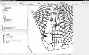
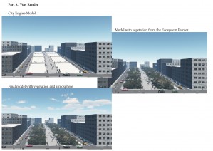
This exercise explains how to create detailed 3d models from geographic data utilizing ArcGIS, CityEngine, and Vue software. Tutorial Files The tutorial will cover three main steps: 1. Exporting vector linework (streets) from ArcGIS10 2. Importing line segments into CityEngine, creating models, exporting to Vue 3. Importing models into Vue, adding vegetation and atmosphere (clouds), […]
-
Exporting Contours from ArcGIS to CAD
(This page assumes that the user is familiar with the ArcGIS interface, layer attributes, tables, and toolboxes. It also assumes that the table associated with the contour layer contains an entry for each contour line.) In order to export contours from ArcGIS to AutoCAD with elevation data, you need to make sure there is a […]
-
Working with Interchange Files (*.e00 files)
Many agencies provide GIS data as interchange files (*.e00). This is because all features and their related files can be compressed into one file. To use the data, you will need to convert the file to a coverage file. ArcCatalog > View > Toolbars > ArcView 8x Tools Conversion Tools > Import from Interchange File […]
-
Georectifying / Georeferencing
Georectifying is a tool that allows you to transform paper maps, CAD files or other images into an ArcGIS layer. This is handy especially for historic maps, aerial photos, data found on-line that is not digitally available, or print data. This can also be of use when you do not have the information you need […]
-
Commonly Used Analysis Tools
-
Coordinate Systems and Projections
One of the basic principles of GIS is that data layers must align spatially for them to be accurately analyzed. When 2 (or more) layers do not align, we must convert them to a common spatial reference system. This page discusses the concepts of coordinate systems and projections, and at the end, gives instructions on […]
-
Managing Data Using ArcCatalog
ArcCatalog allows users to access and manage data stored in folders on local disks or relational databases on the network. Data can be moved, copied, deleted and quickly viewed before added to the map. ArcGIS organizes data sources into folder hierarchies. It recognizes 4 different types of workspaces: Folders: folders may contain other folders, geodatabases, […]
-
GIS Data Available Over the Internet
General US Geological Survey (maps, imagery, national data) www.usgs.gov USGS National Center for Earth Resources Observation and Science http://edcsns17.cr.usgs.gov/EarthExplorer/ USGS Digital Elevation Models http://data.geocomm.com/ http://www.mapmart.com/ http://www.atdi-us.com/ NOAA Digital Coast http://www.csc.noaa.gov/digitalcoast/data/index.html GIS Data Depot http://data.geocomm.com/ Federal Geographic Data Committee http://registry.fgdc.gov/ The Geography Network (ESRI) http://www.geographynetwork.com/data/index.html Geospatial One Stop http://gos2.geodata.gov/wps/portal/gos National Historical Geographic Information System http://www.nhgis.org/ National […]
-
Intro to ArcMap 9.3
GIS Files When you look at a folder containing GIS data in a normal window, notice that there are multiple files with similar names, in sets of around 5-9. The similar names signify that all of these files are associated with a layer you can use in GIS software. The file types signify different types […]


