
Modeling Infrastructure as Connective Tissue

Map of assigned area includes lower portion of Mississippi River corridor between Baton Rouge and New Orleans
My assigned section is bisected horizontally by the lower half of the Baton Rouge to New Orleans Mississippi River corridor. The 144,000 ft by 192,000ft area shows over 30 miles of refineries and suburban towns stretching from Lutcher to Meterie, Louisiana. The topography, transport infrastructure, ecotones, urban development of this area almost exclusively runs parallel or immediately perpendicular to the river. This model studies how the cultural and economic geography follows the form of the river by stringing together the strips of terrain with the transport infrastructure. The strips of terrain are divided to scale with the French arpent system along farm, road or subdivision housing lot boundaries and includes both the soil, levees, and buildings in its topography. The transport system is represented by metallic elements. The railroads, highways, and pipeline are made from pewter color piano wire. The levee is folded strip of copper and aluminum sheet with the silver side showing outwards. The river is made from masonite as a continuation of the contours of terrain but formed from stacking 1/4 thick sheets with river contours cut out to differentiate it from the vertical strips of terrain beyond the levees and painted silver to maintain the metallic transport language.
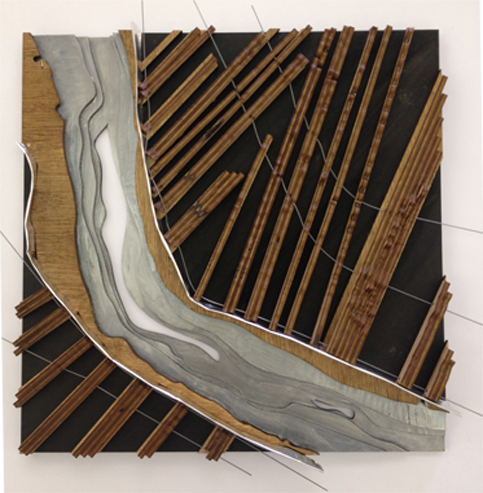
final model
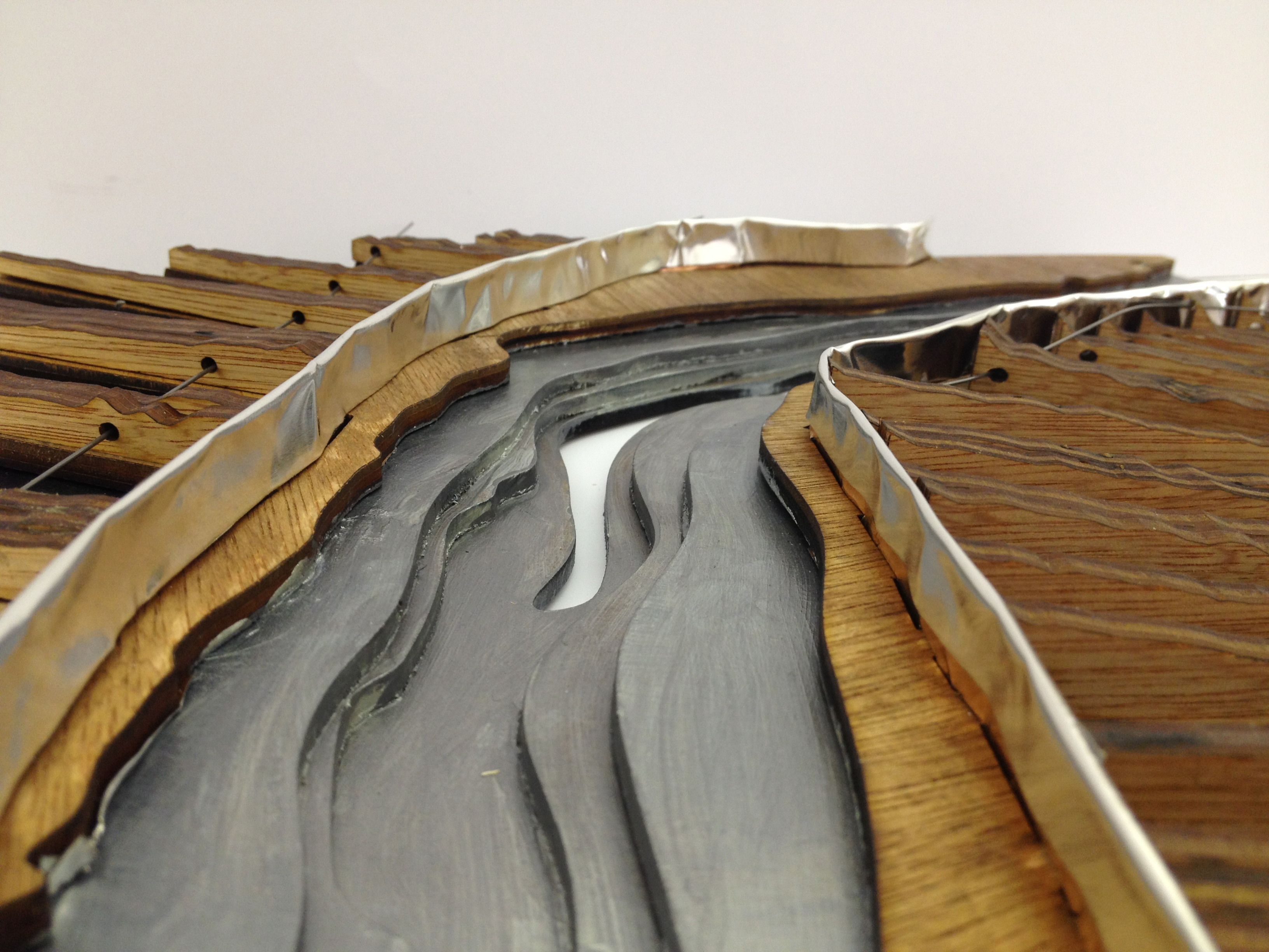
final model: view along the river
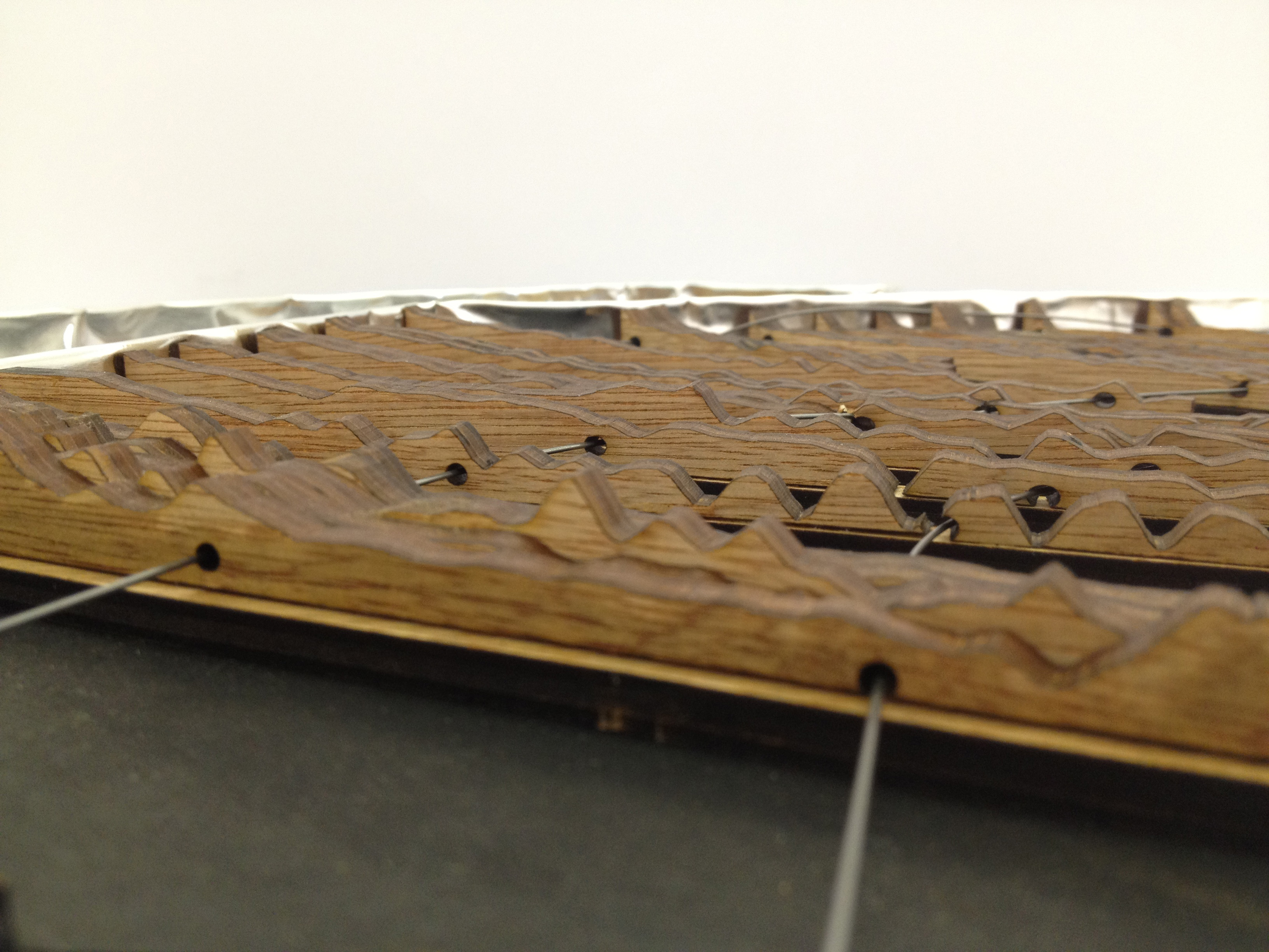
final model : close up of represented terrain and infrastructure
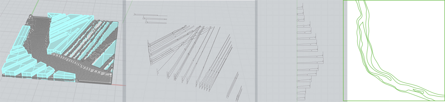
This terrain was first built in Rhino, converted to 2D sections, exported to Autocad, cut out from 1/4th inch thick hardwood plywood then glued to their below sea level base and finally strung with metallic elements creating a piece that bore some resemblance to the interior of a piano. The below directions detail the essential steps performed in digital model construction but excludes the roundabout extra steps taken as I figured out this methodology.
1. Open Autocad Plan view line work of arpents, river edge and levees in Rhino
2. Use Heighfield command to create mesh with max height of 0.5 inches (model horizontal scale is 1″ = 1000′ but v10x vertical exageration gives 1″ = 100′. The GIS dem file for the area noted that the elevation ranged from -5 to 45 ft therefore equaling 50 ft difference between the highest and lowest points
3. Trim mesh by extruding curves and planar surfaces 1 inch and using these levees as cutting edges
4. Pipe the roads, railroads and pipelines. Move them vertical near the surface
5. If not done already, save the two sides of the river as two seperate Rhino files. This is necessary because the arpents along which the sections will be cut don’t match on both sides of the river
6. Cut a total of 47 sections along the center of arpents. Select all objects or booyen them all together before section is cut. Sections don’t differentiate between solid and hollow outlines so either method works. This is an incredibly time consuming step because unlike terrains built from stacking sheets of the same height this can not be done with one simple command. If the arpents all ran perfectly parallel to each other the contour command could have also been used with respect to a vertical plane. However, because this model was highlighting the changing angle of the river and how the land divisions responded to this change, this step could not be simplified
7. Each of the 47 sections then must be oriented into a single plane. Move and rotate each section twice in a deliberate and organized fashion so that know where each piece will align during assembly
8. Export to Autocad and orient within 32 x 18 inch sheets for laser printer
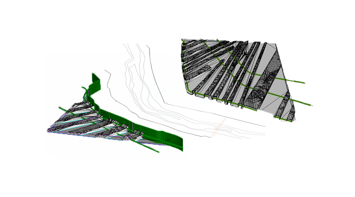
rough exploded axon shows how the terrain was built in total of 3 sections. The arpent strips of land were pieces were built in Rhino and the river in Autocad
digital modeling process