Modelling a Water/Levee Relationship
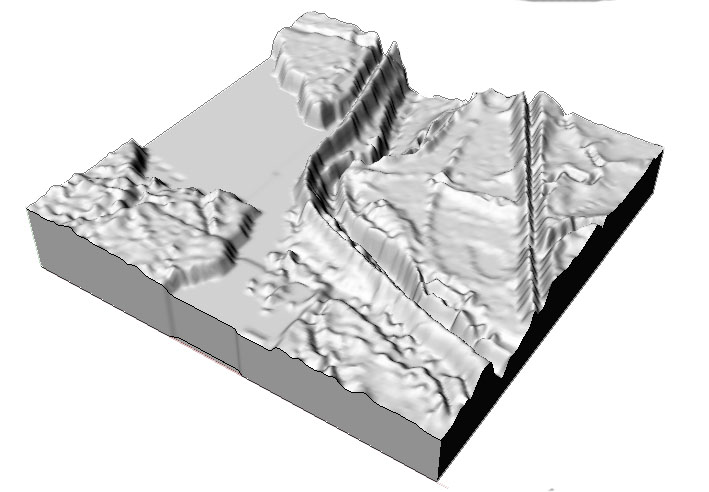
The site that I modeled is an inland swamp area that includes part of Lake Fausse Pointe and a water channel, separated by a levee road. It is this separation of the two water bodies that I decided to investigate further with my modelling process.
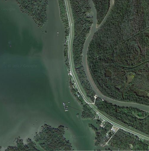
I pulled together 4 digital elevation maps in ArcGIS to get a complete contour reading of my site.
Next, I exported the DEM file to Rhino to create a 3D version of the terrain.

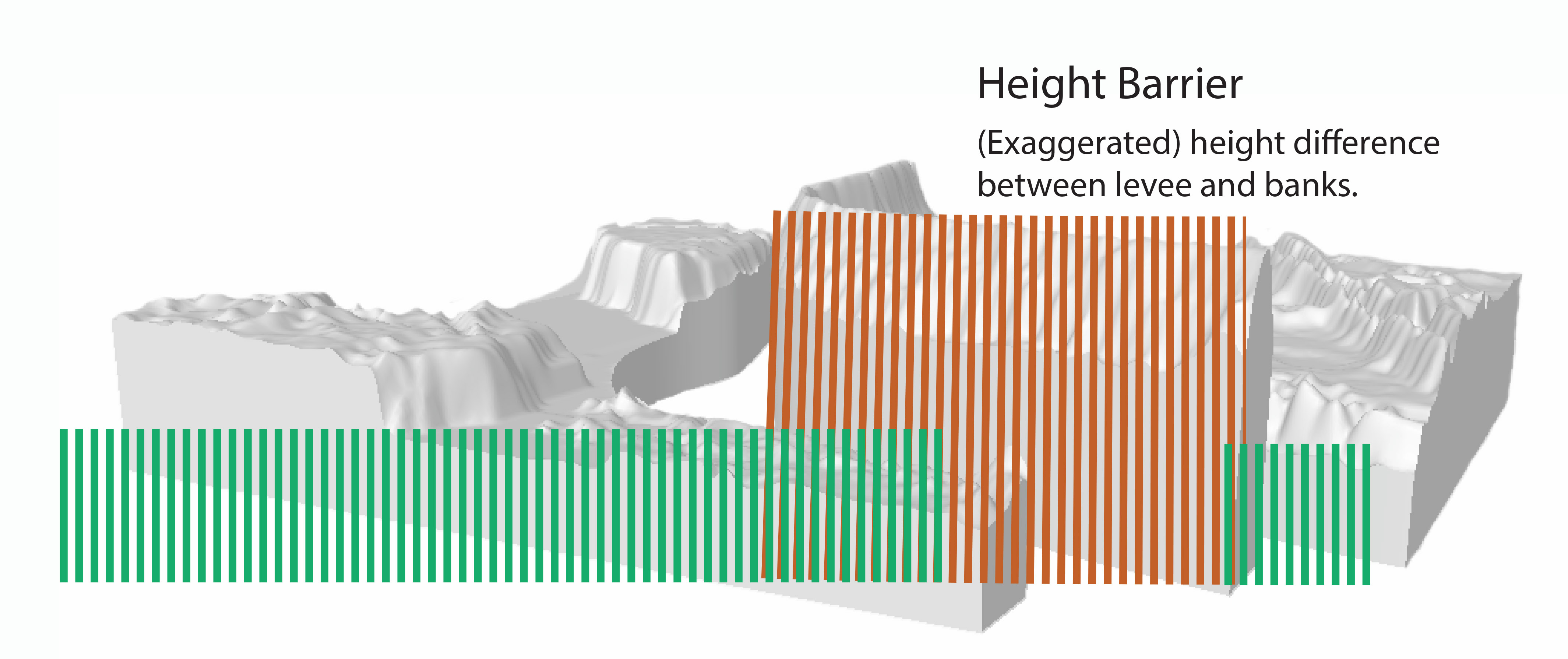
I decided to exaggerate the terrain height by manipulating control points in Rhino. I wanted to emphasize the height of the levee as an impassable structure, or barrier, that separates the 2 water bodies.
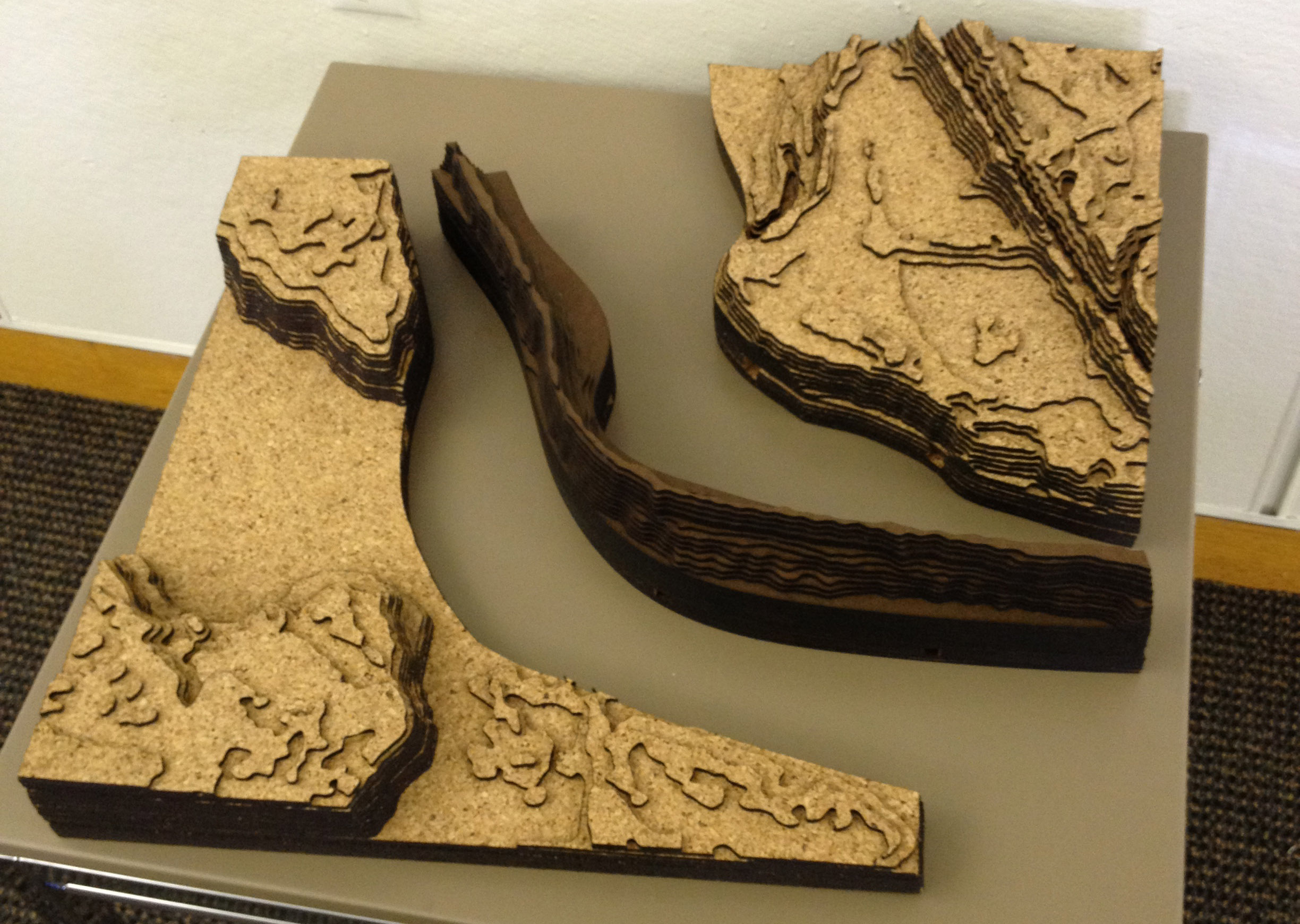
I divided the model into 3 pieces to further demonstrate the disconnectedness that the man-made levee structure imposes on the two water bodies/land masses. If the levee had not been built, these water bodies might be a continuous unit instead of divided areas of water. To do this, I used the line and split tools in Rhino.
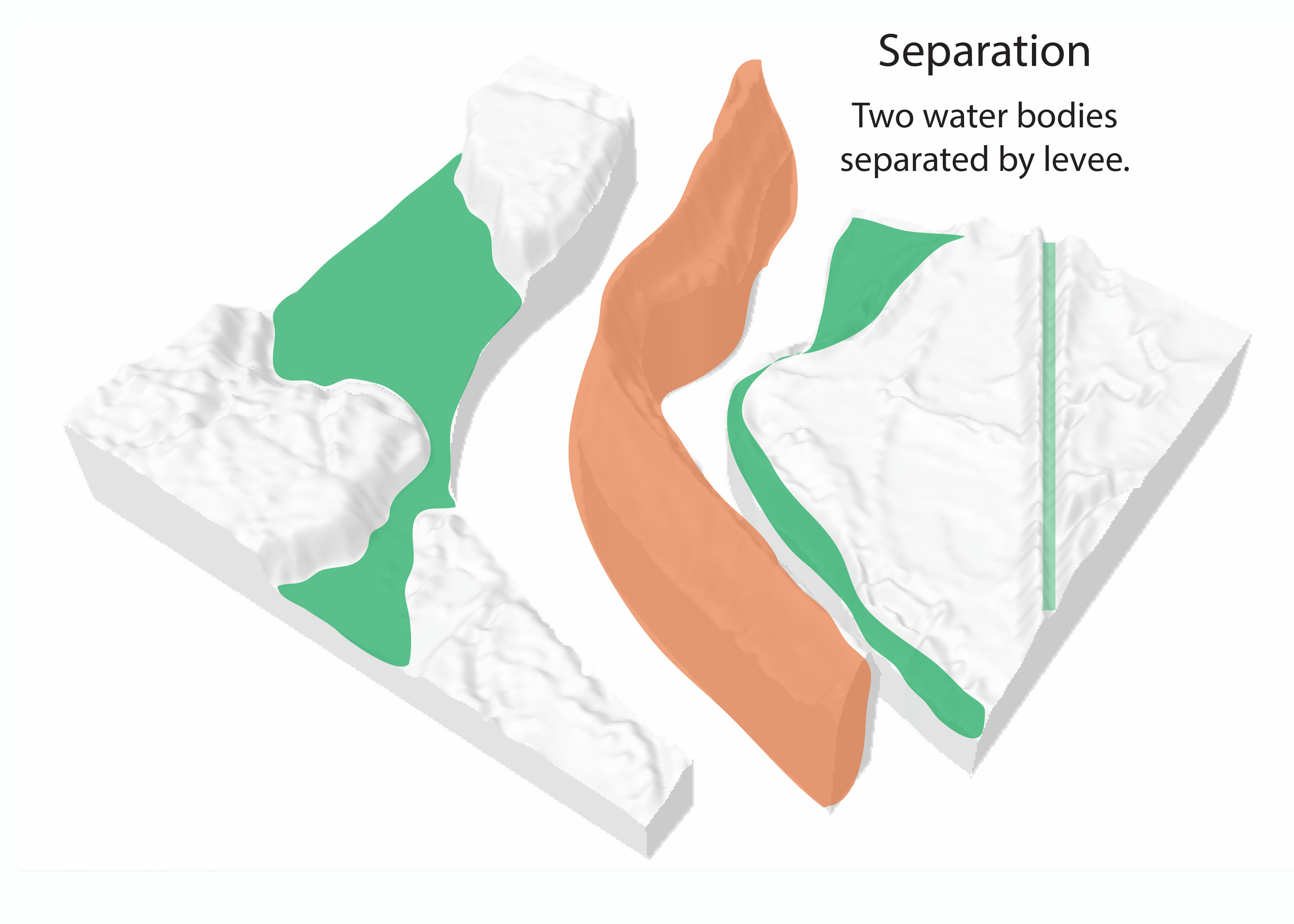
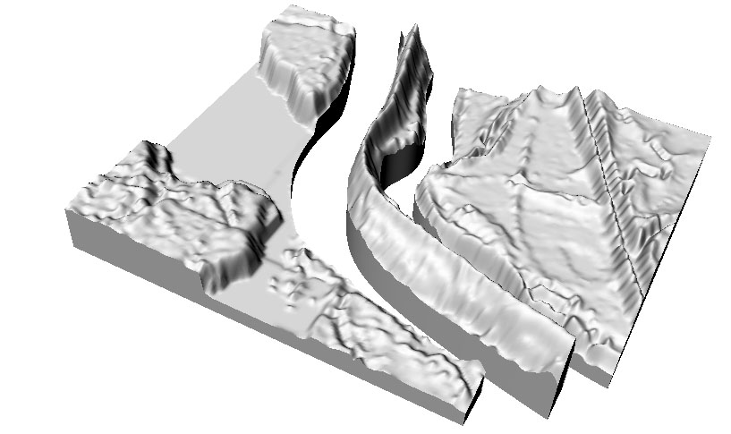
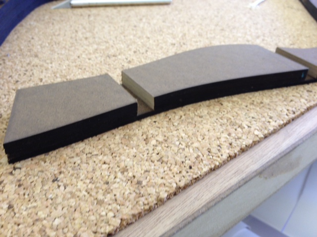
I used the plane and split tools to further manipulate the heights of the two water pieces, making them shorter than the levee piece.
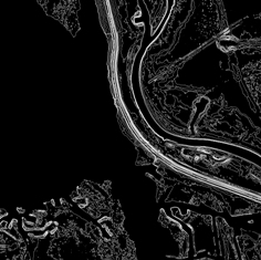
Contour lines were added in Rhino.

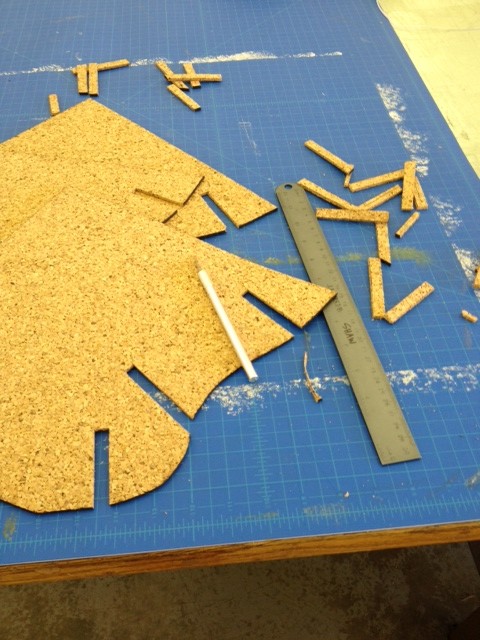
I exported the contours to AutoCAD and laid them out in preparation for laser cutting. This image shows the contours from the Lake Fausse Pointe side of the model laid out on 32″x18″ templates that would fit on the laser cutter bed. The green lines express areas to be cut, while the red text signifies areas to be etched. The numbering system helped me keep track of the layering process when I put my model together.

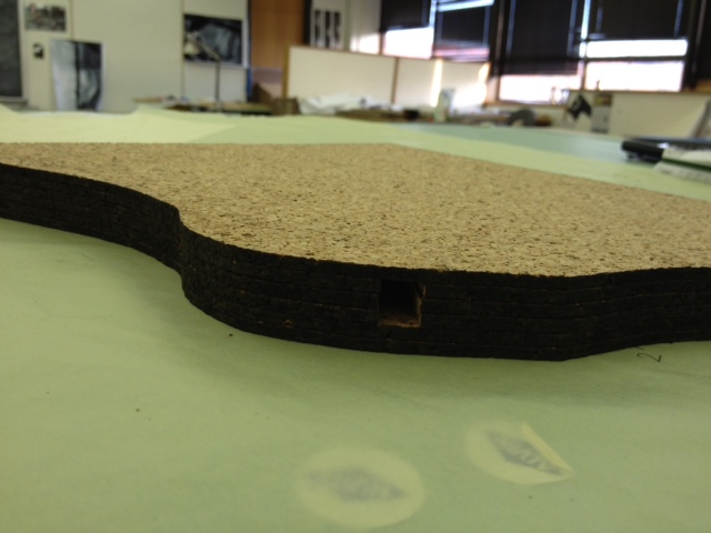
I decided to use cork for the two water body portions of my model to exemplify the permeability and porousness of the inland swamp. In contrast (but also keeping with a wood material theme), I used masonite as the levee piece to demonstrate the solidity and purposefulness of the levee that was imposed upon this landscape. While the two materials came together to form a unified model, they juxtaposed each other well. The cork was lighter in color and weight, and the masonite was dark, solid and heavy, reinforcing the purpose of the material choice.

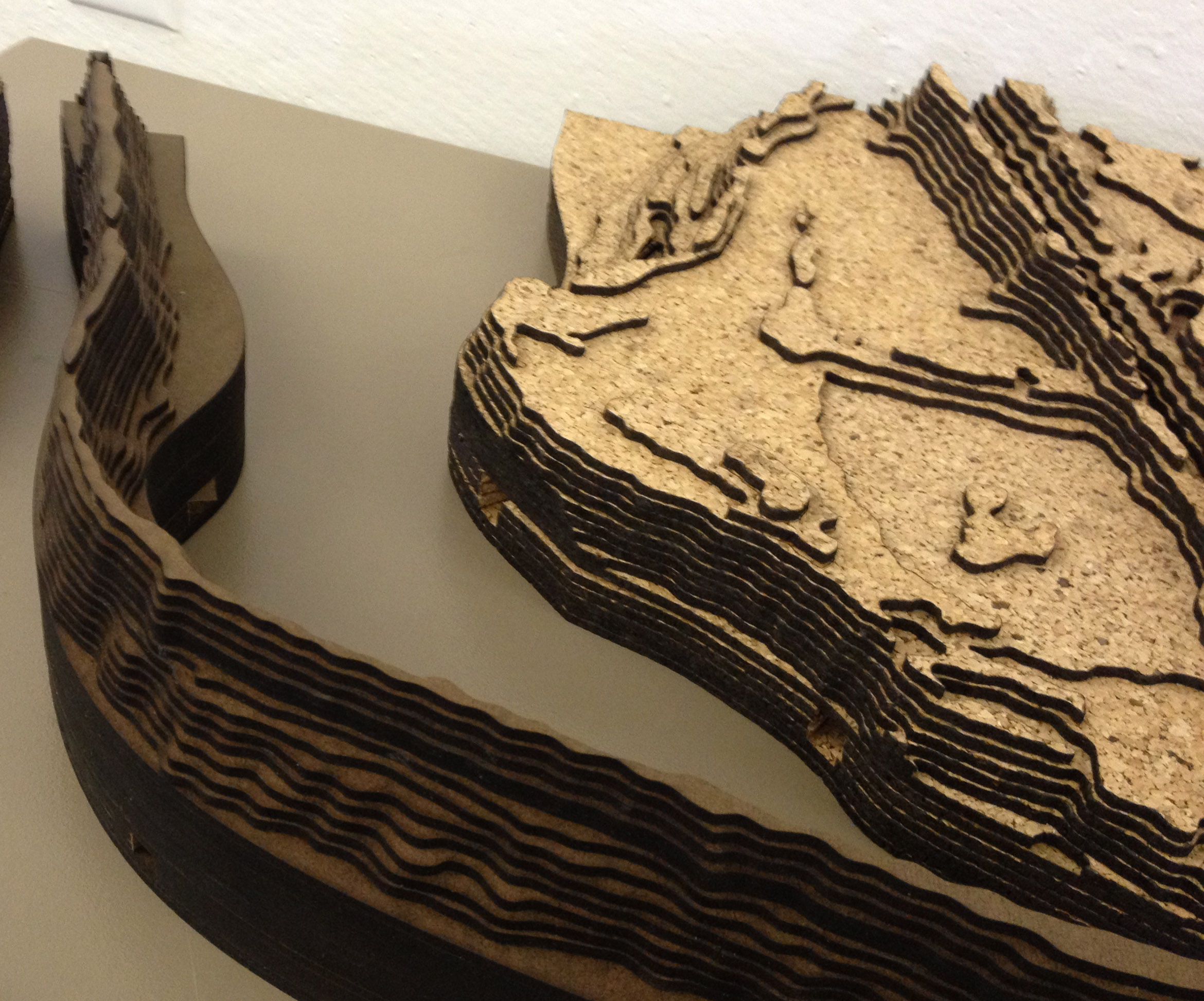
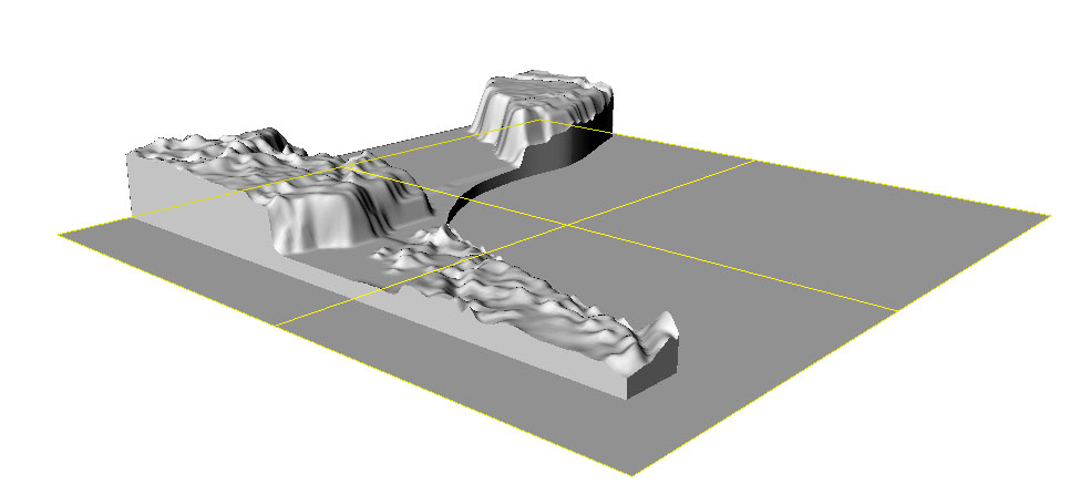
Though most of this model is about separation of the water by the levee, I thought it importation to expose a cross-levee relationship of the water. I demonstrated possible pumping stations by manually removing cork (by hand) and masonite (by band saw) to create a series of holes that align through the model. These holes represent a relationship between the water, despite the levee. If one of the water bodies floods, the excess water can be pumped into the other water body. It was important that my model show the holes through the levee (though I understand pumping stations do not pump through a levee) as an indication that, though the levee is a barrier, these water areas are still connected. 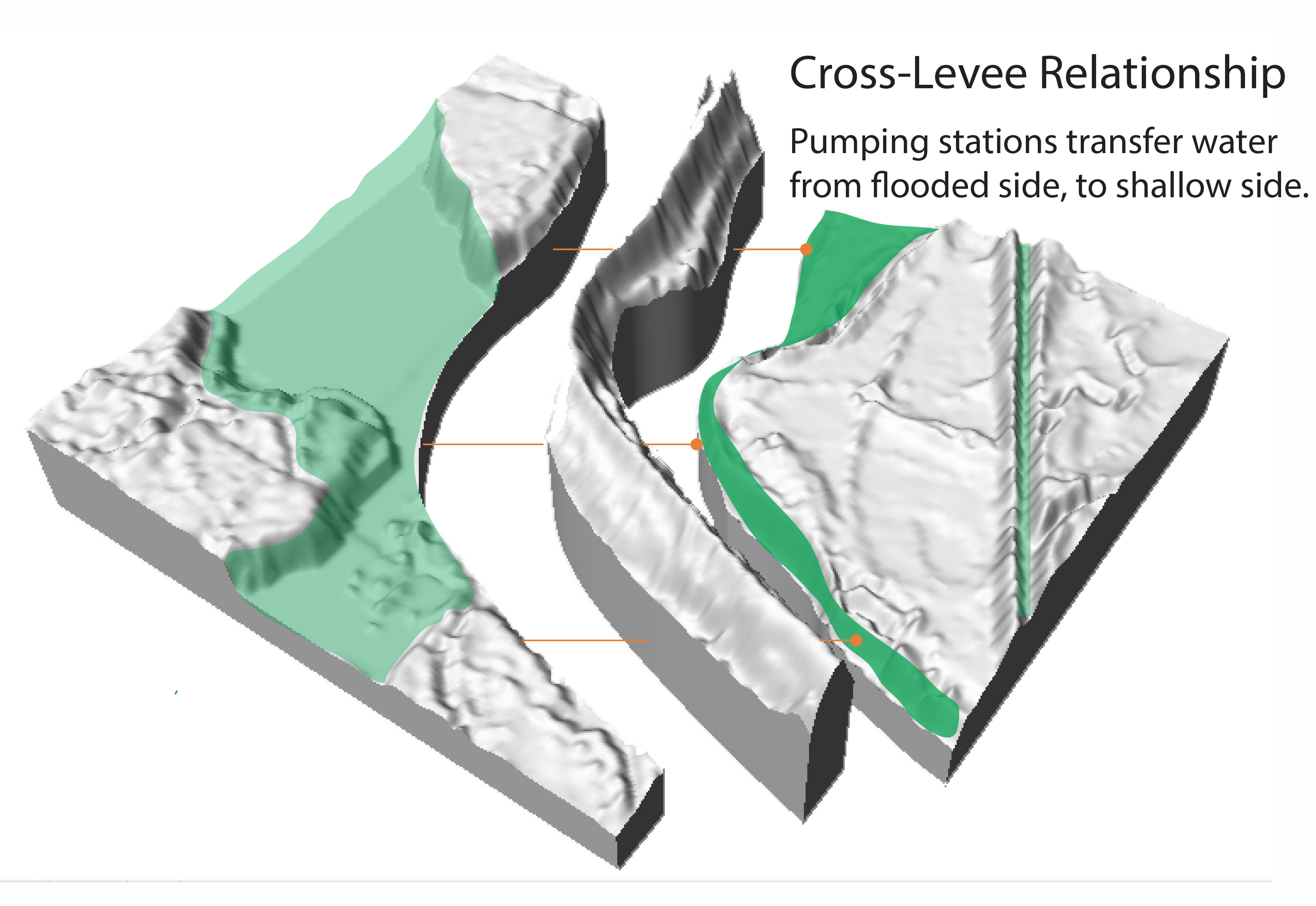
This model is meant to be a representational exploration of a water/levee relationship that was investigated through my use of digital and analogue tools, material choices and site understanding.