Modeling the Impact of Dredge Canals
I focused on studying dredge canals and pipelines and their impact on deltaic coastal marshes and barrier lands ecoregion. I started out by mapping manmade interventions like pipelines, highways, railroads etc. in GIS. Through my research and mapping I realized that most of the infrastructure runs east to west whereas the natural drainage pattern is from north to south. The dredge canals prevent sediment buildup thereby causing land subsidence and salt water intrusion.

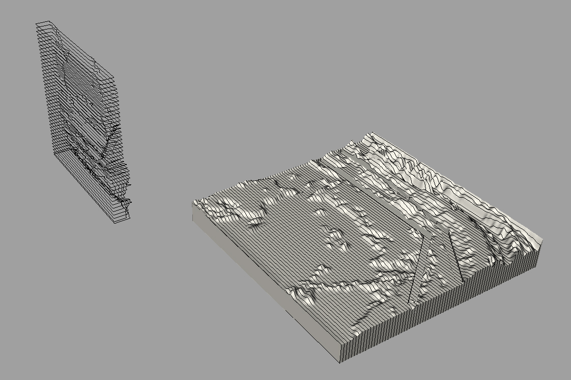
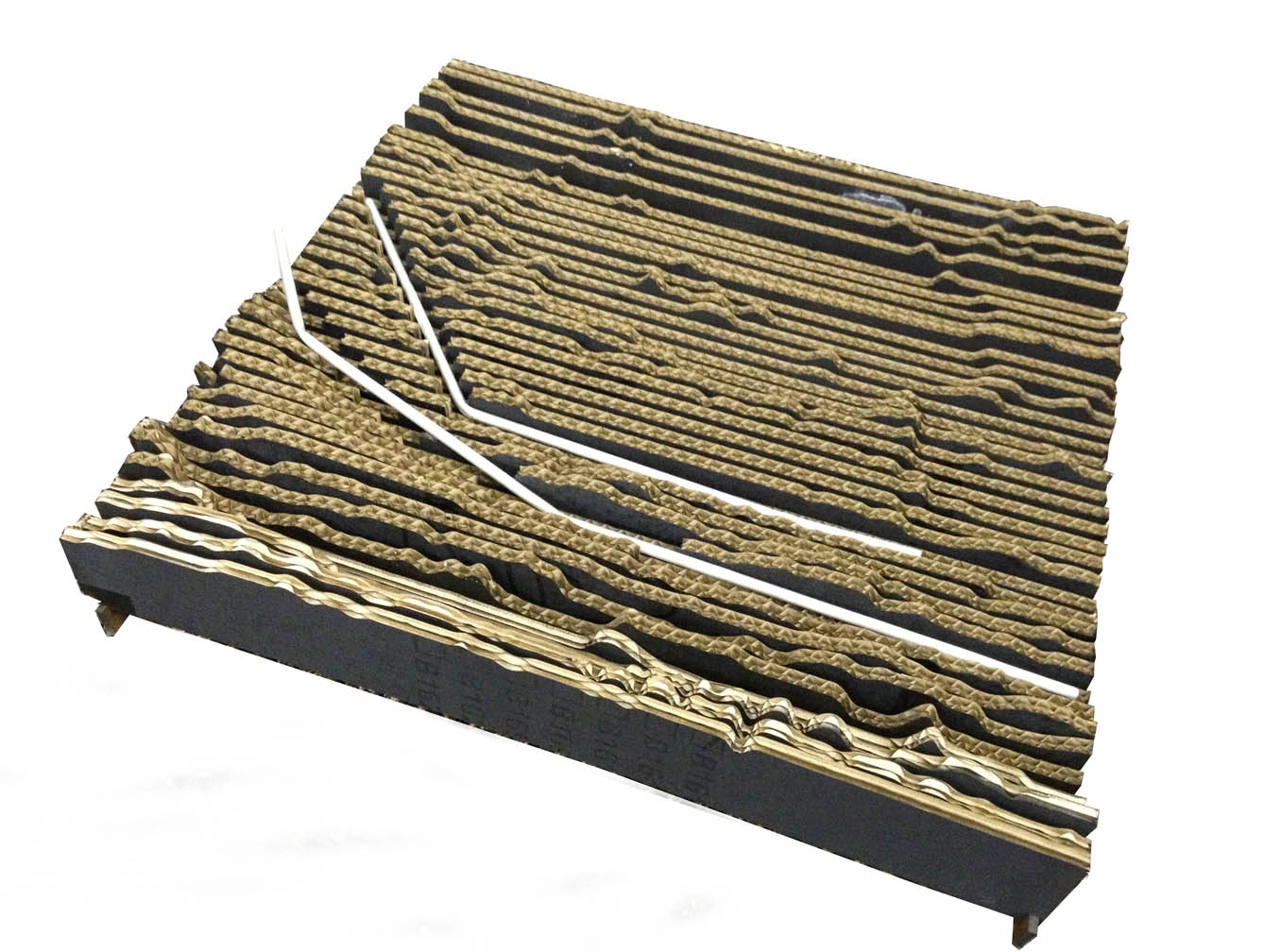
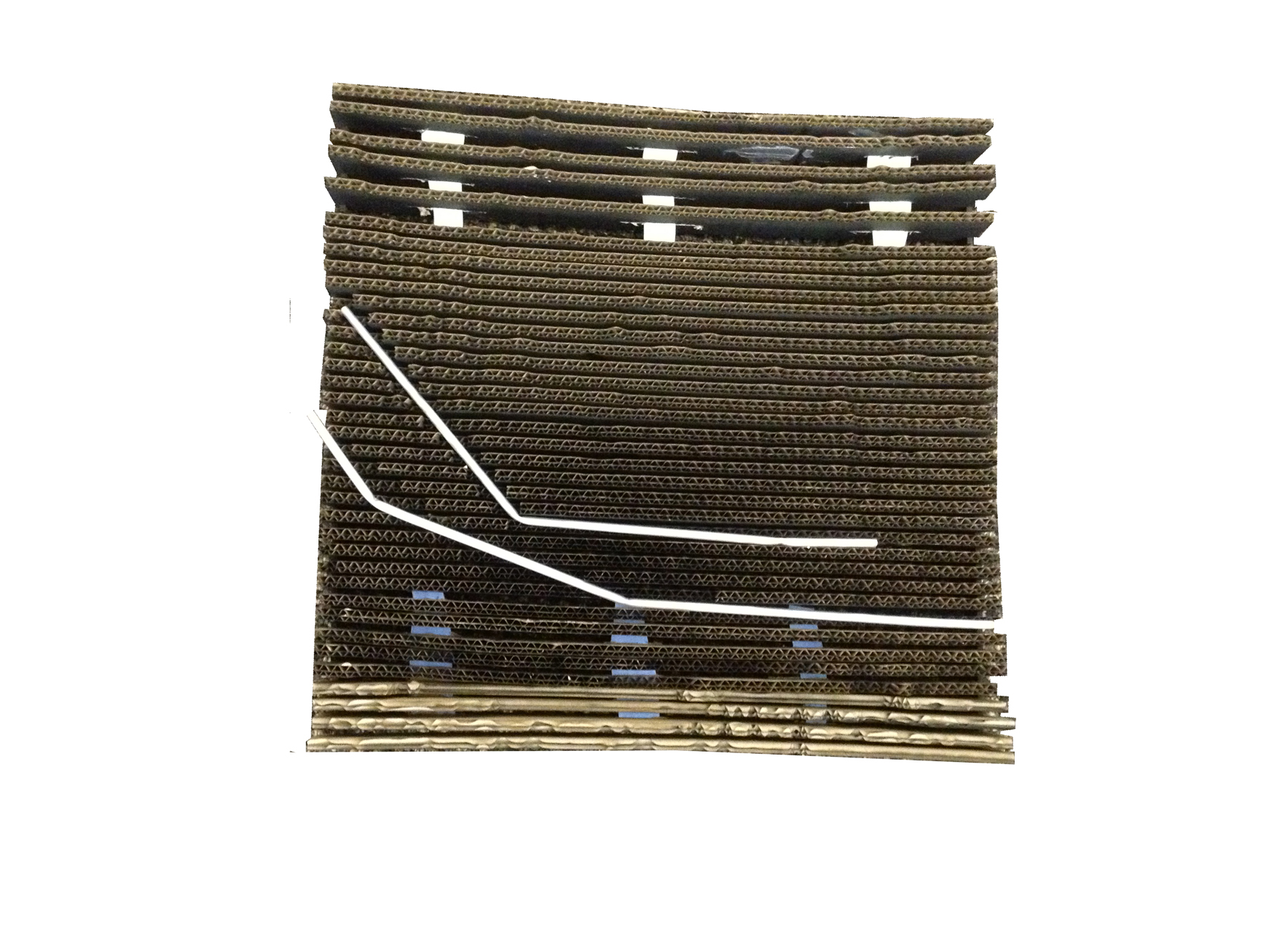
Hence, for modeling in rhino, I chose an area which lies in the northern edge of the ecoregion just below Morgan City where there is a larger concentration of pipelines. In my model, I emphasized on the pipelines and dredge canals by exaggerating these features. I chose to cut contours vertically in rhino and build a terrain with laser cut corrugated cardboard sheet. These sheets were placed at a distance from each other to create the terrain. This method of model building depicted permeable nature of the marshlands. Blue and green sheets of paper oriented perpendicular to the cardboard sheets represent fresh water and salt water respectively. Furthermore, I removed some sections of cardboard to show land subsidence resulting from salt water intrusion.