Mississippi River Delta Formations
The Mississippi River Delta is the area of land built up by alluvial deposits from the Mississippi River at the mouth of the Gulf of Mexico. This process has led to the extension of the Louisiana coastline into the Gulf 15-50 miles and the creation of vast coastal wetlands and salt marsh. The representation of this process requires the isolation of sediment and the demonstration of its origin, flow, and depositional patterns as well as the expression of the impact of this process on Louisiana’s coast.
Framework
Deltas occur throughout the world, except at the poles.
They all have three characteristics in common :
1. The presence of a large drainage basin.
2. A large river system that carries large quantities of sediments.
4. A river system that ends at a large body of standing water.
3. A geologically inactive coastline
The framework portion will illustrate the connection of the Mississippi River system, which begins in Minnesota, and the large water body, the Gulf of Mexico. The representation will likely involve an analog model of the Mississippi River Basin to demonstrate the source and flow of sediments through the system.
Process
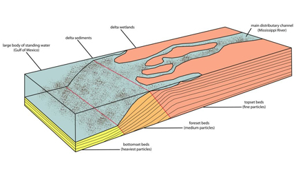
Mississippi River deltas form where the sediment from the Mississippi River reaches the mouth of the Gulf of Mexico and is released from the confinement of the levee-bound channel. With more space to occupy, the sediment expands in width which leads to a decrease in flow velocity. As the movement of water slows, it loses the ability to carry the sediment further. The sediment drops out of the flow and is deposited near the mouth, resulting in a lobe.
The formation of a river basin is usually characterized by the shape of a delta or triangle. Because of their lower mass, finer materials are transported farthest seaward. Fore-set beds are composed of coarser sediment and form the advancing front of the delta. These beds usually have a steeper slope than bottom-set beds and are a continuation of the alluvial plain. In the case of the Mississippi River Delta, an elongated bird’s foot takes shape due to local subsidence and human interference with hydrology.
The rate of loss of the Delta has increased to surpass the rate of formation. Sea level rise and man-made control structures lead to saltwater intrusion, which kills vegetation protecting the shoreline from erosion.
Experience
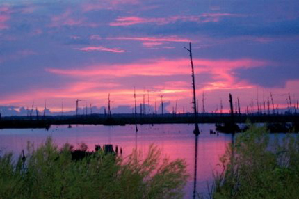
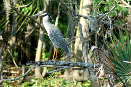
Wetlands host a variety of recreational activities including fishing, hiking, camping, birding, painting, and photography. Trees commonly found in wetlands include the Bald Cypress, Tupelo Gum, and Cottonwood. Other plants in abundance are the Saw Palmetto, Wax Myrtle, Duckweed, Water Hyacinth. Animal species native to the area include egrets, osprey, alligators, and beavers.
The Experience portion will illustrate the natural beauty of the River Delta while providing subtle references to the disappearing wetlands. This may be an animation depicting the changing quality of the area over time as sediment builds up and diminishes with original imagery from the process portion making its way onto the delta shores and slowly washing away.


