
Technique Document – Combine 3d model with Collage
Our group intend to reconnect the Bayou Lafourche and Mississippi River in the future. So, we collect the information of historical events of the Bayou Lafourche and Mississippi River.

Before 1905, the Bayou Lafourche was connected with Mississippi River. Then, after 1905, the Bayou Lafourche was disconnected with Mississippi River, resulting in the water of the bayou less than before, even dried up. So, we want to reconnect the Bayou Lafourche and Mississippi River, reviving of vitality of the bayou.
3d max
1. Extract the contour from the dem image in ArcGIS.
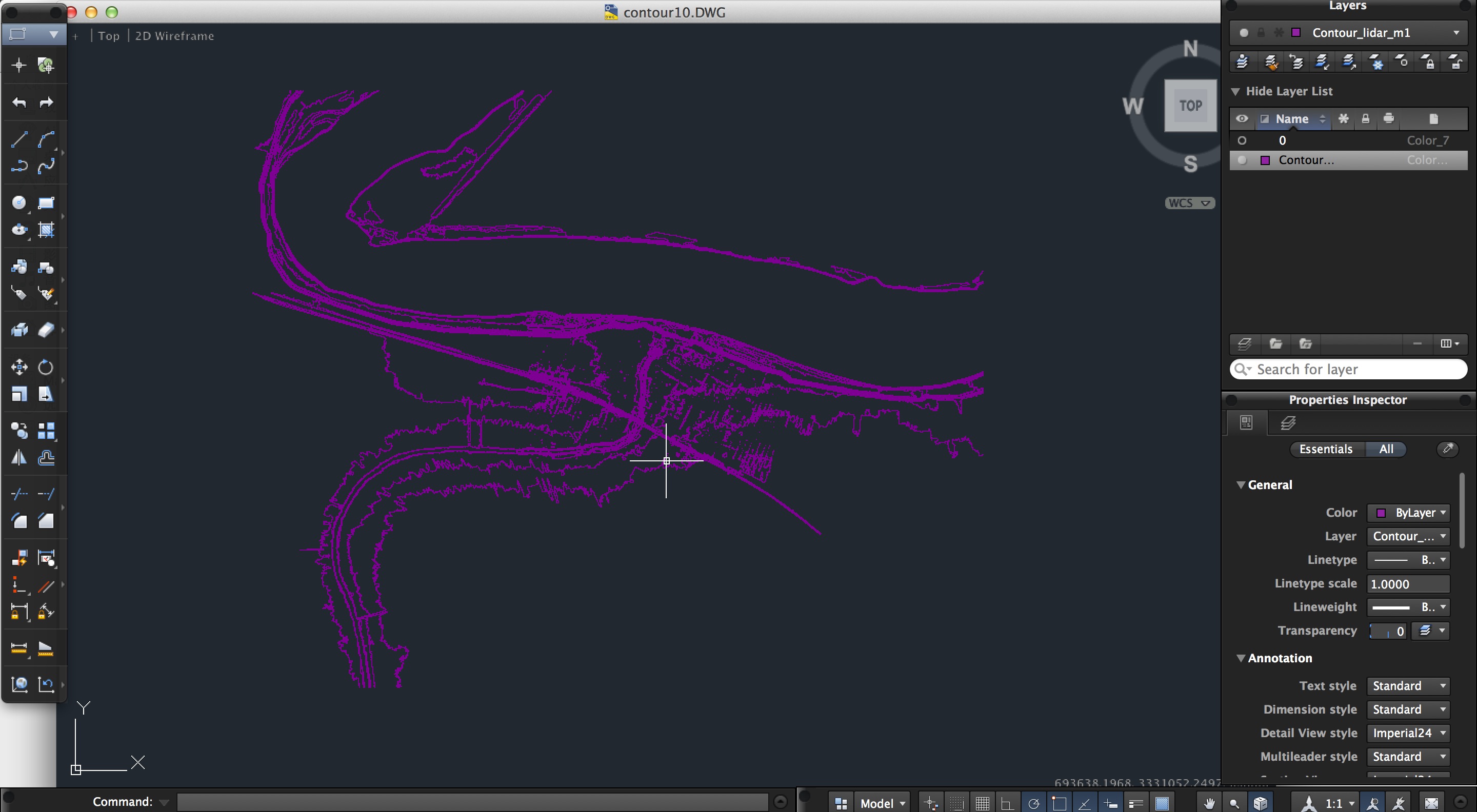
Then, make some changes of these contours satisfy our transformation in CAD.
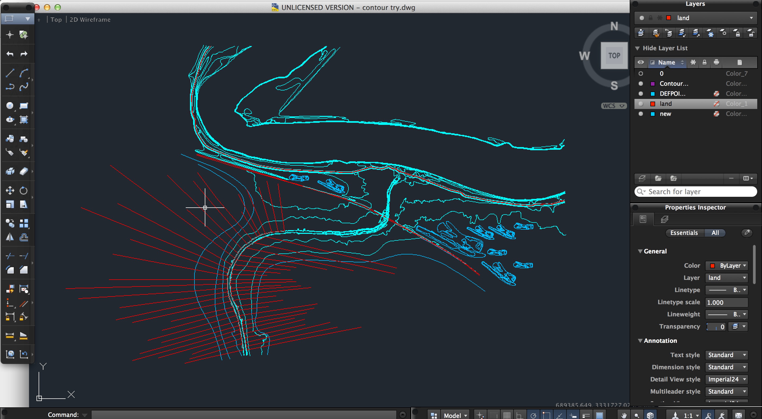
Import the contour into 3dmax. Use Terrain to create the topography.
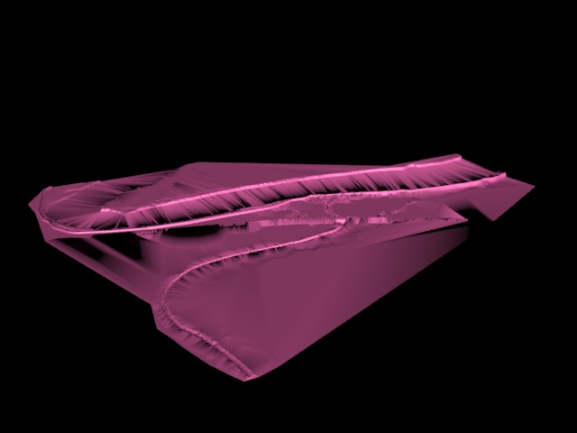
2. Create the 3d model of a bridge and a flexible dam in 3dmax.
3. Combine them in one image.
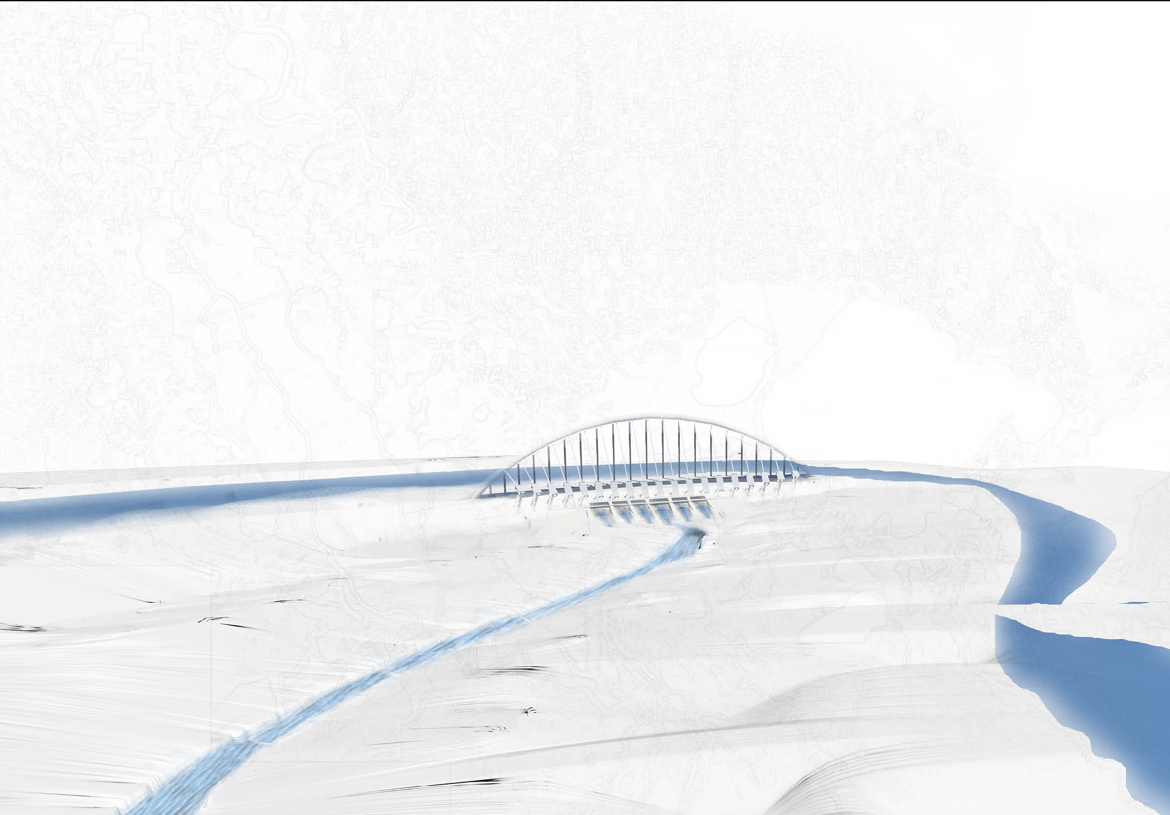
4. Use collage to illustrate the perspective image of the joint area.
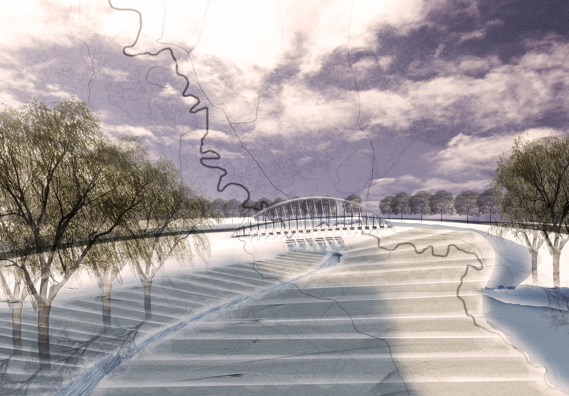
5. But from the perspective image, we are not clear with the part which is from the new levee road to the Mississippi River. So, I create a relative section of that part combined with the perspective image.
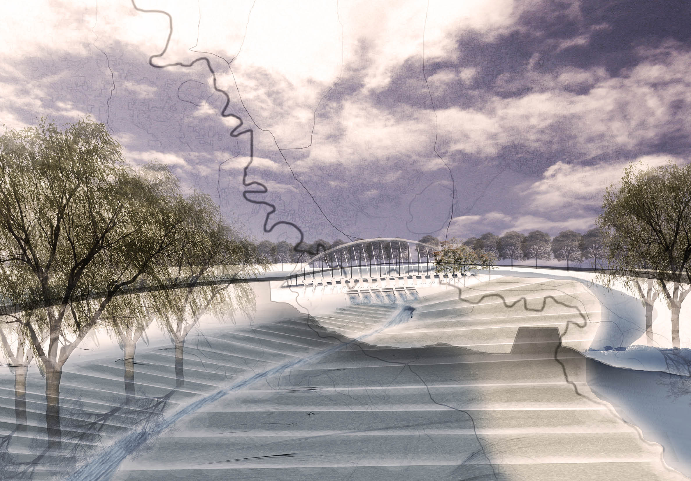
Though the relative section is not in the accurate scale, it illustrates the hidden part behind the new levee road and connects with the Mississippi River.