Model for Planning – Qianhai Port City – OMA
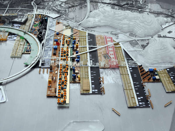
More than a tool to represent, for OMA, models are also tools for analysis. Such 3D diagrams make information much intuitionistic – filted elements formed in scale which could make a container of information into a real space or building, and the connection between them becomes road which based on real terrain. It’s a smooth and convictive method to build the structure form logic to form.
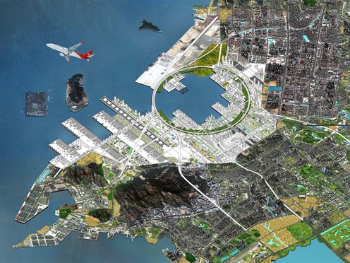
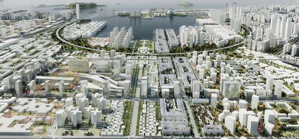
The following example is a model of masterplan for former harbour site. The project called Qianhai Port City is located in Shenzhen, the shreshold of Hong Kong and Mainland China, the position of which is trategically significant in the Pearl River Delta. The planned intensification of transport through the site renders inevitable its emergence as a new center. Designers of OMA tried to use models combining diagrams to figure out how Qianhai will develop. If successful, a new city center in Qianhai could fulfill Shenzhen’s coastal ambitions and establish a node for interaction between various components of the PRD.
The existing use of the site consists primarily of infrastructure, transportation, and logistics. The operations of the port and its related functions define the quality of much of the site and adjacent areas. What if, rather than attempting to suppress or insulate these uses from new development, they are considered as latencies capable of forming the identity of a new city? Can the introduction of new urban conditions benefit from and reinforce the existing (port) conditions of the site?
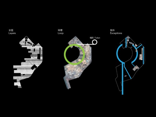
The design organizes the site in a series of parallel bands running east-west. The irregular extension of these layers into the Qianhai Bay and Pearl River Estuary creates piers and increases the proximity of the city to the water. The layers form a stack of different and juxtaposed types of space, each varying in terms of architectural typology, density, and landscape.
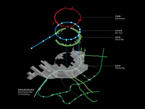
On top of the layers, a circular loop of 3.4km diameter is superimposed to delimit the Qianhai Bay and relate to Shenzhen’s other center. Whereas the layers provide difference and diversity, the loop provides cohesion and unity. The loop is the glue of the city; it consolidates infrastructure, transportation, and circulation. It also intercepts and redirects major expressways to maintain the contiguousness of the Qianhai Bay. Within its 250m width, the loop contains a vast, continuous park and the most public elements benefiting from proximity to nature.