-
Fluctuating Infrastructure
FLUCTUATING INFASTRUCUTRE INTRO The water flow of the Mississippi has many factors that influence where it turns, bends, rises, falls, increases in speed, or even decreases in speed at some points. These factors are known as levees, dams, spur dikes, and locks. There are 29 locations where these locks/dams are located along the Mississippi, 27 […]
-
Algae Cultivation
Framework As the world’s energy demand continues to rise, there exists a concurrent increase in greenhouse gas emissions stemming from fossil fuels consumption. As a result a need for renewable energy sources is rapidly expanding. Biofuels represent a large segment for potential energy, but as ethanol has demonstrated, finding an energy source that doesn’t compete with […]
-
Cadgis Printing
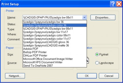
Printers 8.5×11 $0.10 bw $0.25 color 11×17 $0.25 bw $0.50 color Plotters 36” bond $1.50 bw $2.00 color (per linear foot) 36” Matte $6.00 per linear foot 36” Glossy $8.00 per linear foot 24 hour plotting 1.80 per linear foot (bond plotting only) Current Cadgis Hours and Plotting Information 24 Hour Plotting is now available […]
-
Working with Interchange Files (*.e00 files)
Many agencies provide GIS data as interchange files (*.e00). This is because all features and their related files can be compressed into one file. To use the data, you will need to convert the file to a coverage file. ArcCatalog > View > Toolbars > ArcView 8x Tools Conversion Tools > Import from Interchange File […]
-
Georectifying / Georeferencing
Georectifying is a tool that allows you to transform paper maps, CAD files or other images into an ArcGIS layer. This is handy especially for historic maps, aerial photos, data found on-line that is not digitally available, or print data. This can also be of use when you do not have the information you need […]
-
Commonly Used Analysis Tools
-
Coordinate Systems and Projections
One of the basic principles of GIS is that data layers must align spatially for them to be accurately analyzed. When 2 (or more) layers do not align, we must convert them to a common spatial reference system. This page discusses the concepts of coordinate systems and projections, and at the end, gives instructions on […]
-
Managing Data Using ArcCatalog
ArcCatalog allows users to access and manage data stored in folders on local disks or relational databases on the network. Data can be moved, copied, deleted and quickly viewed before added to the map. ArcGIS organizes data sources into folder hierarchies. It recognizes 4 different types of workspaces: Folders: folders may contain other folders, geodatabases, […]
-
Municipal Technologies | Wastewater Management | US EPA
Municipal Technologies | Wastewater Management | US EPA. Managing Wetlands to Control NPS A large resource of technologies from the EPA site. This applies to a broad range of solutions for treatment wetlands and other infrastructure.
-
GIS Data Available Over the Internet
General US Geological Survey (maps, imagery, national data) www.usgs.gov USGS National Center for Earth Resources Observation and Science http://edcsns17.cr.usgs.gov/EarthExplorer/ USGS Digital Elevation Models http://data.geocomm.com/ http://www.mapmart.com/ http://www.atdi-us.com/ NOAA Digital Coast http://www.csc.noaa.gov/digitalcoast/data/index.html GIS Data Depot http://data.geocomm.com/ Federal Geographic Data Committee http://registry.fgdc.gov/ The Geography Network (ESRI) http://www.geographynetwork.com/data/index.html Geospatial One Stop http://gos2.geodata.gov/wps/portal/gos National Historical Geographic Information System http://www.nhgis.org/ National […]

