-
Creating a Section Using Google Earth
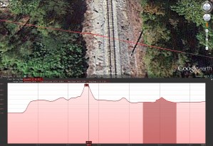
This method allows you to quickly find a section cut line from the terrain models that are part of Google Earth. Keep in mind that the results shown have an exaggerated vertical elevation which may not work in some situations. The vertical exaggeration can be adjusted by re-sizing the window, although this cannot be accomplished […]
-
AutoCAD . Scale and Rotate by Reference
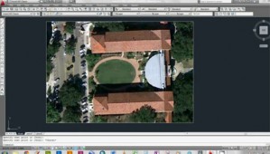
AutoCAD . Rotate and Scale by Reference from Bradley Cantrell on Vimeo. Rotating and scaling an image by reference. The tutorial is by Peter Graves at the LSU Robert Reich School of Landscape Architecture
-
LA 1102 . Mini-Assignment 01
LA 1102 Mini-Assignment 01 from Bradley Cantrell on Vimeo. Creating a diagram in Adobe Illustrator based on an underlying image. The tutorial is by Lucas Frey at the LSU Robert Reich School of Landscape Architecture


