-
Creating a Terrain with the Displace Modifier
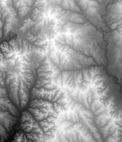
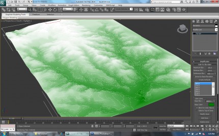
First you will need to get a Digital Elevation Model (DEM) of a specific location. In this case we are using a DEM of the NW Laurel Hill (Louisiana) USGS quadrant. You will need to convert the DEM file into an image file (such as jpg) using GIS. Black represents low areas, white represent high areas. Check […]
-
Creating a Terrain with Contour Splines
First you will need the contour data for a given site; this can usually be obtained from GIS and converted to AutoCAD. In this example we are using contours from Laurel Hill Louisiana. 1. Open up 3ds Max and select file, import and navigate to your AutoCAD contour file and select open. 2. The following […]
-
Printing Body Parts
Image from the Economist Interesting article in the economist about printing body parts. The possibilities are fantastic and possibly frightening, I would say I lean towards fantastic on this one. The printing of biological systems leads us to believe that not only will we be able to replicate but also iteratively engineer/design new systems. Is […]
-
A Miniature New York
Video: A Miniature New York – Gothamist. This was sent to me from LSU MLA 2010 student Tom Grubbs. image from The Gothamist This is a great example of how framing can change the perception of scale in representation. By manipulating the the focus plane Sam O’Hare created “The Sandpit,” a time lapse film that […]
-
experience
[experience] As the system works with the park, we believe that those subsystems such as prairie and wetland are not only dealing with water filtration, but also providing marsh habitats for migration birds. Additionally, golf ponds are no long isolated from the large ecosystem. They could also be part of bird habitats such as bird […]
-
process
[process] The process will deal with water conveyance, filtration, and usage system for using the collected rainwater in golf courses. This diagram implies that there might be four components in the system including urban surface, urban BMP, prairie, and wetland. As rainwater flows through this system, contaminants, such as dust, trash, and metal, and chemical […]
-
Framework
The Mississippi was once an untamed force that carved out any direction it wanted to go. It was in a world where nothing hindered it allowing it to have its way against the landscape. Overtime, it became a controlled force due to man creating settlements and providing the proper way for the river to flow. […]
-
Experience
Experience After exploring the rivers sediment deposition process closely, it begins to set up a story that explains what happens in the changing course of the river. The sediment plays a significant role that causes the river to fluctuate the way it does. As observed in a more detailed view through the process, the experience […]
-
Process
The unpredictability of a meandering river can be something very beautiful in the landscape, but it can also be seen as something that has the potential to create serious problems when it comes to local settlements and river crossings. A meander is formed when the sediment from the outer bank (concave bank) of the stream […]
-
framework
[framework] As we know, golf courses are usually targeted as utilizing excessive amounts of water. It is reported that each golf player takes around 2500 gallons of water per day to support his game based on golf course average water use. This is the reason why golf courses are usually blamed by the society for […]


