
Salt Domes

reaching for the surface
Salt domes begin as salt deposits in the sea that after a period of time, are cut off from the main body of water. The surrounding water evaporates and allows sediments to cover the salt pans. Because the salt was less dense than the surrounding sediments, it pushed its way toward the surface, creating roughly circular topographic prominences with desirable resources beneath its surface; salt and petroleum. The surfaces range from 23-52 meters above sea level.
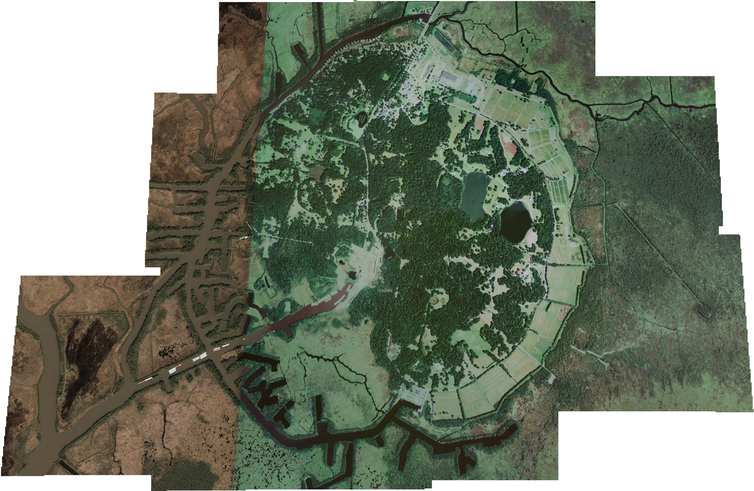
In Louisiana, there are 5 salt dome ‘islands.’ These are not correctly named islands, but are called so because of their prominence above the land. Avery Island, showed above, is surrounding by marsh.

Jefferson Island is located on Lake Peigneur in Iberia Parish.

topography
In 1980, the salt mine was penetrated here causing a dramatic event where a vortex swallowed over 65 acres of the surface.
Where salt and fresh water mix and the gulf flowed backward through the Delcambre Canal.